|
SPECTACULAR THUNDERSTORMS - NOVEMBER 6, 2000 The morning started off quite differently to previous storm days - a band of cloud and rain had developed overnight, and temps were quite mild. However, by mid morning the cloud began to clear, revealing blue sky to the W and SW with plenty of Accas. As with previous days, storms began developing in NE NSW by late morning. Storms also began forming on the eastern Darling Downs and SW SE coast distrct of SE QLD around 1pm, and gradually moved ENE. Over the next few hours a line of avitivty would develop, with the strongest part NW of Brisbane at first, but as this line approached the coast, the southern end dramitically intensified. I was chasing in the northern suburbs of Brisbane as this line approached, and photographed a Gustnado (a name given to a tornado that develops from the gust front of a storm) from Strathpine, looking NW. 
Filters have been applied to the above
image to make the
David Findlay also saw this Gustnado from Redcliffe, and another very large (~100m wide) area of rotation along the gust front as the line approached him. Unfortunately he was unable to take pictures. Anthony Cornelius also photographed a funnel cloud from the same storm that produced the above tornado. His report with pictures will be up ASAP. The southern end of this line continued to intensify, and a magnificent shelf cloud developed. The pictures below were taken around the Strathpine/Bracken Ridge/Sandgate area.   
Click here for a chase report, including a series of pictures showing the line developing
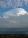
Anthony spierings photographed this line from the Bracken Ridge area, which is around the same area the pictures above were taken from. Ross Portas also photographed this line from the southern suburbs of Brisbane. Some trees were brought down in the Strathpine area and 5000 people were blacked out from this line. No damage has been reported from the Gustnado. Several storms also formed around the eastern Border Ranges and Gold Coast area during the mid to late afternoon. The tops on these cells were quite spectacular, and several people took pictures. The following pictures were taken from Sumner by John Woodbridge, looking south towards the Gold Coast/Border Ranges area.   
The following pictures were taken by Jason Rainforest from Pimpama, also looking south towards the Gold Coast/Border Ranges area.   
A picture series for this storm is available below
The following pictures were taken by Steve Baynham from the Gold Coast A strong storm moving through northern parts of NE NSW around 3-3:30pm Steve also photographed 2 spectacular storms
during the late afternoon. The pictures for these are


Click on any thumbnail to see a full size version. Report by Ben Quinn |