|
SHOWERS AND THUNDERSTORMS - JANUARY 21, 2000
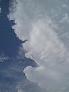
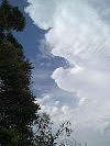
There were reports of severe weather from these storms, with dozens of large trees down around Kilkivan (roughly 60k's NW of Gympie) trees over the Bruce Highway in the Bundaberg area. Luckily most storms developed and stayed in largely unpopulated areas. The following photos were taken of the activity around Brisbane and the eastern Sunshine Coast Hinterland - unfortunately there are no photos of the stronger activity further N and NW. These are taken by myself around the Glass House Mountains/Sunshine Coast area.     Anthony Cornelius and Steve Baynham managed to get the following photos of a storm between Brisbane and the Gold Coast mid afternoon. Anthony's photos are from the eastern suburbs of Brisbane while Steve's photos are from the Gold Coast (looking north towards the storm).
Report
by Ben
Quinn
|