|
SHOWERS AND THUNDERSTORMS - NOVEMBER 23, 1999 What was first thought to be a marginal storm day for Brisbane turned out to be one of the most photogenic of the season. Late in the afternoon isolated storms began developing well inland on the border ranges. These gradually strengthened while moving ENE, becoming quite a solid complex moving towards the coast between Brisbane and the Gold Coast. Steve Baynham managed to film this complex and stills from his footage are below.
Although there were no reports of severe weather from this storm there were intense echo's on radar suggesting extremely heavy rain and/or hail.
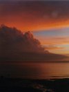
As it neared the coast it weakened, but as this happened another isolated storm developed to it's NW. This storm moved NNE towards Brisbane, with waves of fresh growth on the western edge, lasting well over 2 hours. The thick boiling updrafts from this storm coupled with a brilliant sunset made for a great photo opportunity.
The following photos were taken by myself from the northern suburbs of Brisbane, looking south.


The following photos were taken by Damien Howes from the southern suburbs of Brisbane, looking north.


And last but certainly not least, the following photos were taken by Marty Barritt from just north of the Brisbane CBD.


This storm was severe, with reports of wind strong enough to shake buildings in the Brisbane CBD and several large trees were brought down in the eastern suburbs of Redcliffe as it crossed the coast and moved out to sea, dissipating shortly later.
Report by Ben
Quinn
|